
Held at: | Private collection |
Reference: | gc |
Source: | Research on Tithe Map schedule |
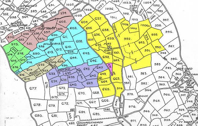
Title: | Some Land owners in part of Michaelchurch, Map 10 |
Place name: | Michaelchurch Escley |
Date: | 1840’s |
Description:
Some properties and their owners in part of Michaelchurch at the time of the Tithe map of 1844
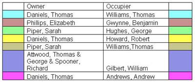
Holding | Owner | Occupier |
Wilderness Farm | Thomas Daniels | Thomas Williams |
New House | Elizabeth Phillips | Benjamin Gwynne |
Cae Vattock | Sarah Piper | George Hughes |
Firs Farm | Thomas Daniels | Robert Howard |
[Letty’s Ach/Llety’r Wrach] | Sarah Piper | Thomas Williams |
Grove Farm | Thomas & George Attwood & Richard Spooner | William Gilbert |
Cottage & Garden | Thomas Daniels | Andrew Andrews |
Names in brackets [ ] are from other sources
|
|
to see associated maps click here
Observations:
None
Ref: gc_mic_3010