
Original Maps of
THE PARISHES OF HEREFORDSHIRE
are obtainable from:
Geoff Gwatkin, 92 Verschoyle Gardens, Ross-on-Wye,
Herefordshire. HR2 7HQ
Tel: 01989 565852
E-mail: geoff.gwatkin@btinternet.com
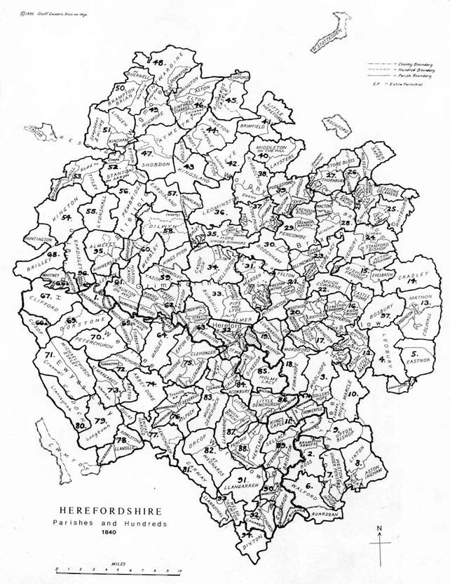
The series of maps are based on the tithe surveys of the mid 19th. Century, supplemented by enclosure and estate surveys.
They give as full a view of the area as sources will allow, including field names, land uses, ancient boundaries and buildings. Lists of landowners are supplied with the A1 maps where possible.
The maps are available in various formats:
1. A1 black and white copies for research, at a scale of 6 inches to 1 mile
2. A3 hand-drawn and coloured in ink and ink wash on tinted card with appropriate lettering and title, usually at a scale of 8 inches to 1 mile, individually commissioned and centred on a chosen location (to form decorative and informative works of art)
3. Hand-drawn & coloured maps of individual parishes or townships in ink and ink wash on tinted card with appropriate lettering and title, at scales varying from 6 to 8.5 inches to 1 mile.
4. Colour copies of maps already produced are sometimes available
Prices and availability are detailed on www.geoffgwatkinmaps.co.uk
The Herefordshire parishes and hundreds covered are illustrated below:
|
|
Similar maps are also available for the Parishes of Gloucestershire
The Ewyas Lacy Study group, who have no commercial interest in the sale of these maps,
thank Geoff Gwatkin for allowing the use of extracts from his copyright material on this site
Ref: GG_ewy_0002