
Held at: | Internet |
Reference: | http://archaeologydataservice.ac.uk/archives/view/phillips_2005/ |
Source: | Internet – Archaeology Data Services [University of York] |
Title: | Earthwork Castles of Gwent and Ergyng AD 1050-1250: Pont Hendre Castle |
Place name: | Longtown |
Date: | 1050 - 1250 |
Description:
This summary concerning Ponthendre Castle is an extract from a Doctoral thesis by Dr N Phillips, University of Sheffield (2005), entitled ‘Earthwork Castles of Gwent and Ergyng, AD 1050-1250’. This thesis is concerned with the earthwork and timber castles built in the southern March of Wales, addresses the presence of the castles and discusses their roles as weapons of conquest and structures of administrative control.
PONT HENDRE - Grid: SO 32572 28109
Introductory note:
Pont Hendre has already been considered earlier in this chapter because of its relationship to Longtown Castle. It was decided in the Longtown description that documentary evidence pre 1170 would refer to this site at Pont Hendre.
Location:
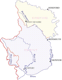
Pont Hendre castle is situated in the Olchon Valley at the eastern foot of the Black Mountains. The castle stands just outside the southern end of the village of Longtown, which can be reached from the A465 Abergavenny to Hereford road. The road to Longtown branches off the A465 to the north of Pandy. The site lies to the west of the road just before the bridge over the Olchon Brook.
Description:
The site of the castle stands on a high point above the road. Its form is that of a large mound that has been separated from the ridge by a massive ditch. The aerial photograph, (Vol. 2. plate 213) shows the layout of the site, the motte being to the west. The motte is almost round in shape with a domed profile (Vol. 2. plate 214). Almost no flat surface is to be found on the top of the motte which could mean that a collapsed structure of some sort is buried there. Two sections of ramparts enclose the south and north of the motte and provide a partially enclosed bailey (Vol. 2. figure 98). The bailey has a scarped bank to the west, which along with the ramparts, can also be seen on the aerial photograph above, and the next photograph (Vol. 2. plate 215). Of particular interest is the rampart on the west which appears to provide a slope on one side and steep banks on the others. The fourth photograph shows this rampart from the top of the motte (Vol. 2. plate 216). A similar feature has also been noted at Llancillo earlier and was interpreted as a bridge base.
The bailey of the earthwork which is enclosed between the two arms of the rampart is flat and featureless with the exception of a modern drainage ditch. There area is quite marshy which may have been a problem when the castle was in use.
Topographic survey: (Survey 43)
The earthwork at Pont Hendre consists of a large motte with a maximum height of 10.6m, top surface area of 121.303m², and a partially enclosed bailey with a surface area of 2151.234m². The motte has been constructed by cutting a very large ditch through the edge of a hill to the west, effectively isolating a mound to which spoil has been added to raise the resulting motte to a greater height than the surrounding landscape. The effect of the work can be seen on the east/west cross section A-B on the survey plan (Vol. 2. plate 213). It can be assumed, because of the existence of the surrounding ditch that the base of the motte is close to its original size, as is the motte height, judging by the steepness of the surviving slope and the small surface area of the top. The ditch has been rock cut in places and at its deepest point measures some 3.27m in depth and 6m in width. There can be no mistake in assessing the effectiveness of the defences of the motte.
The same cannot be said for the bailey for although it is protected to the north by a rampart above a steep natural slope, and to the south and east, by further slopes, the west is well below the height of the ridge and so vulnerable. In this aspect it shares a design flaw with Ewyas Harold, discussed above.
The southern edge of the bailey is quite interesting in that it is edged by a slope which becomes a rampart with an abrupt end some 3m above the surrounding field. A similar feature, though considerably smaller, was recorded at Llancillo where it was interpreted as a ramp base to allow access to the motte top by way of a bridge. It is worth noting the curious weak spot in the defence, seen to the west of the terminal end of the ramp, providing an unrestricted approach to the motte (Vol. 2. surveys) It could be that the rampart has been breached where it once continued to the ditch edge thereby enclosing the motte more effectively. A small crescentic rampart also edges the north side of the bailey but this does not reach the height of the southern one.
Geophysical survey:
A geophysical survey of the bailey area and lower south slope was used to establish a function for the two areas. No anomalies were evident in the bailey other than drainage channels but to the south there may have been some occupation structures.
Strategic position:
The site itself provides a high vantage point above the surrounding area, perched as it is on top of a hill. There is no obvious strategic importance to the site other than establishing a presence along the Monnow valley.
Documentary evidence
Primary reference:
Db.H records Roger de Lacy as holder of Longtown (Thorn and Thorn 1983. 184 a).
Modern reference: HWCM1038
Marshall wrote that Walter de Lacy was given the lands of Ewyas at the conquest; however, he died in 1085 and his land passed to his son Roger who held it at the time of Domesday. (1938. 148). Unfortunately he does not name his source; however, Walter was the father of Roger de Lacy which would suggest a connection. Purser was in agreement when he argued the frontier castle at Pont Hendre was built by Walter de Lacy in an important position guarding one of the three possible approaches to Hereford; Walter died in 1085 (1994. 76). Purser cites Ordericus Vitalis for mention of a joint expedition by William fitz Osbern and Walter de Lacy into the area before 1071 for the purpose of defence (1994. 76).
Additional references:
VCH 1908. 242-243.
RCHME 1931. 184.
Hogg and King 1963. 118
King 1983. 208.
Interpretation: Motte and bailey (Early)
Interpretation of the site is based on actual surviving remains, geophysical survey, topographical survey and location. The size and configuration of the motte suggests an early construction period for this motte as there are similarities with Ewyas Harold specifically with the weak position of the bailey in relation to the adjoining ridge height but also in the method of construction. The apparent problem could have been resolved if the bailey had been on top of the ridge, to the north of the motte, as was suggested at Ewyas Harold (see above). Similarly as at Ewyas Harold it is possible that the Normans refortified a pre-existing site that had been built originally for a different function.
The site may well represent one of the advance castles for the frontier conquest moving along the valley from Abergavenny or Ewyas Harold. The proximity of Pont Hendre and Longtown could result from abandonment of the former due to the wet nature of the bailey which appears to have forced the habitation quarters outside the protection of the ramparts. The bogginess of the bailey is caused by a spring which issues from the bedrock located in the cut of the ditch to the north. Although the spring provides water to keep the ditch wet it has effectively removed the bailey area from being of any practical use.
Observations:
The material is copyright by the author, and is reproduced here from the Archaeology Data Service website of the University of York for research purposes under their terms of use
Ref: rs_lon_0261