
Held at: | Private collection |
Reference: | RS/TCF |
Source: | Guest Contribution |
Title: | Turnastone Court Farm: Walkover Survey Report on Features of Archaeological Interest |
Place name: | Golden Valley |
Date: | 2004 |
Description:
Turnastone Court Walkover Survey:
Features ofArchaeological Interest
Interimreport
July 2004
Archenfield Archaeology is a multi-disciplinary archaeologicalconsultancy offering a complete range of archaeological advice and services tothe public and private sector. We specialise in giving archaeological adviceto developers, housing associations and private individuals. We also undertakearchaeological intervention, from watching briefs to full-scale excavation,landscape surveys and geophysical surveys.
| Text: | Huw Sherlock and Daniel Lewis |
| Project Manager: | Huw Sherlock |
| Illustrations: | Daniel Lewis & PJ Pikes |
The authors would like to acknowledge the helpand support of Robert and Chrissie Fraser (the tenants of Turnastone CourtFarm), and Ian Hart and Nigel Housden from the Countryside Restoration Trust.
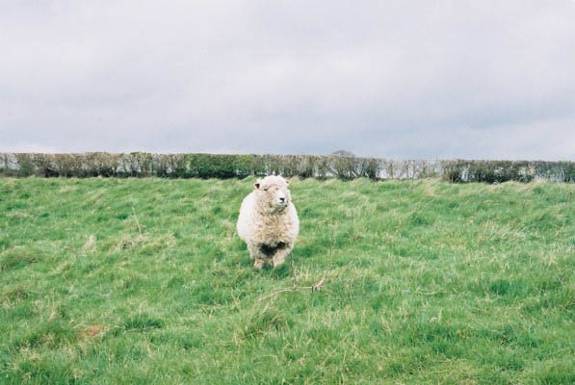
Cover photograph: Oneof the Fraser’s Ryelands Ewes.
Contents:
| 1.0 Introduction |
| 5 |
|
| 1.1 Historical background | 7 |
|
| 1.2 Archaeological background | 7 |
|
| 1.3 Geology |
|
| 2.0 The Results |
| 9 |
|
| 2.1 Changes in land use | 13 |
|
| 2.2 Features identified during the survey | 15 |
| 3.0 Conclusions |
| 25 |
|
| 3.1 Survival of archaeological features | 25 |
|
| 3.2 Recommendations for future management | 26 |
| 4.0 References |
| 26 |
|
| General Bibliography | 26 |
|
| Cartographic material | 26 |
| Figures: |
|
|
| Figure 1: Location plan showing the study area. |
| 5 |
| Figure 2: location plan showing archaeological sites |
| 7 |
| Figure 3: archaeological features identified during the walkover survey |
| 10 |
| Figure 4: Plan based on the 1842 tithe map showing land use at that date. |
| 13 |
| Figure 5: Hedgerows shown on the 1842 tithe plan |
| 13 |
| Figure 6: The extent of Turnaston wood in 1812 |
| 13 |
| Figure 7: The study area showing the field names from the tithe apportionments. |
| 13 |
| Figure 8: Turnaston wood in 1812 |
| 14 |
| Figure 9: earthworks in field 9 |
| 15 |
| Figure 10: earthworks in field 11 |
| 17 |
| Figure 11: quarry 61 with old hedge boundaries to the north-east |
| 18 |
| Figure 12: Limestone outcrop in field 13. |
| 20 |
| Figure 13: grown out hedgerow 59 |
| 20 |
| Figure 14: culvert 65 and an old ditch and bank boundary |
| 21 |
| Figure 15: Turnaston wood 1812 |
| 21 |
| Figure 16: archaeological features in field 17 |
| 22 |
| Figure 17: Turnaston wood 1812 |
| 25 |
| Figure 18: Crop marks in field 22. The Trench Royal lies to the north-east. |
| 25 |
| Figure 19: cropmark 64 |
| 25 |
| Figure 20: the Trench Royal on the edge of field 22 |
| 25 |
| Figure 21: field 25 showing the trackway and hedge boundaries shown on the tithe map. |
| 25 |
|
|
|
|
| Plates: |
|
|
| Plate 1: Part of earthworks 68. |
|
|
| Plate 2: mound 48 |
|
|
| Plate 3: Watercourse 60. |
|
|
| Plate 4: quarry in field 12 |
|
|
| Plate 5: Feature 50 in field 13. |
|
|
| Plate 6: stones from culvert 65 in the south-east corner of field 15 |
|
|
1.0 Introduction
ArchenfieldArchaeology was commissioned by the Countryside Restoration Trust (CRT) tocarry out a walkover survey of the upland areas of Turnastone Court Farm,Turnastone, and Herefordshire as part of a Historic Land ConservationManagement Plan. The brief was to identify features of archaeological interestand to record these photographically, produce survey maps and provideinterpretative data and management advice. Suitably qualified staff conducted abrief walkover survey of fields forming part of Turnastone Court Estate between20th April and the 23d April 2004.
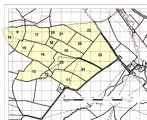
Figure 1: Location plan showing the study area. Ordnancesurvey Super plan data reproduced under license drawing reference number hemc_00003353.
A numberof areas which appear to have features of archaeological interest wereidentified. Brief notes were made and a number of features were photographed.This provisional data was entered into a ©Microsoft Access database.
ArchenfieldArchaeology would like to acknowledge the help and support of Robert andChrissie Fraser, the tenants of Turnastone Court Farm and of Ian Hart, the localrepresentative of the CRT in the preparation of this report.
1.1 Historical background
Turnastoneis a small parish of just 214 hectares (530 acres) in the Golden Valley insouth-west Herefordshire.
In 1086Domesday recorded five manors in the Golden Valley as being held by Hugh l’Asne– Beltrou, Wluetone, Wilmestune, Almundestune and Alcamestune. Of these,only one, Wilmestune, has been identified beyond doubt – Wilmastone.
Thederivation of the first part of the place-name Turnastone has been suggested byBruce Coplestone-Crow.
Accordingto the Hereford Domesday – an annotated copy of the original made a centurylater - the manor of Wluetone was then held by Robert Turuei. Robertseems to have been the son of Ralph de Tournai who was associated with a chapelof St Leonard in the Golden Valley. The family may haveoriginated in Tournai-sur-Dive, Orne.
Thechapel stood at Lower Slough and in 1132 the people of Turnastone were referredto as parishioners of St Leonard. Turnastone is then named fromTournai.
Turnastonebecame a medieval parish but a very small one. It is surrounded on three sidesby the parish of Vowchurch - the churches are only 340 metres apart.
In 1861there were only 10 inhabited houses with a population of 54.
Held byRalph de Tournei (the probable derivation of the name Turnastone or Tournei’ston) the land unit was called Wluetone in the Domesday and was part of Huge LeAsne’s land (f. 187).
1.2 Archaeologicalbackground
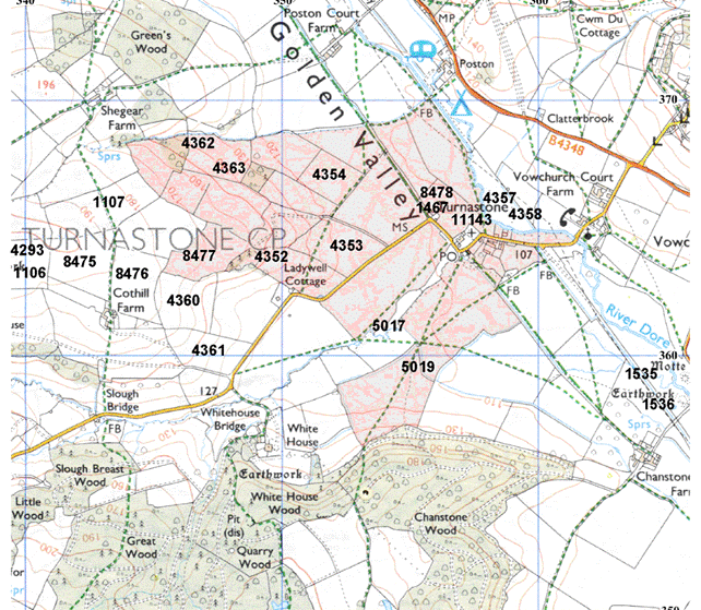
Figure 2: Location plan showing archaeological sites around Turnastone Court listed in theHerefordshire Sites and Monuments Record
Prehistoricactivity has been demonstrated in the area around Turnastone Court with findspots recorded from the Neolithic to Bronze Age. Monuments in the area of asimilar date include Cothill Tump/Camp[1]west of Cothill Farm and a slightly later hill fort with ramparts, in LowerPark Wood, near Poston Court.
Thefields around the site have yielded flints. Flakes, chips and 1 scraper[2]have been found along the west edge and west central sides of the field whileto the north-west of the camp a working floor of flint flakes and chips[3]have been recorded at Dolward.
To thewest of Turnastone Court, at Shearger Farm, three flint knapping sites[4]have been located in fields around the farm. Further flint find sports havebeen located close to a mound; a possible barrow/Motte, close to the RiverDore, south-west of Turnastone Court.
A flintknife[5]and scraper[6]from the late Neolithic/Bronze Age and a middle Bronze Age Palstave[7]have been recorded in Vowchurch, but within a 2km radius of Turnastone Court,and a Late Bronze Age socketed axe [8]has been found close to Turnastone Court.
CothillTump/Camp is a probable Middle Bronze Age barrow approximately 31m in diameterwith a later fortified site described as a low mound and faint possible baileythat has been ploughed out. The castle appears to be of stone with a shell keepon the mound. Mortared stone and foundations have been found around the site(Stirling-Brown 1989). The castle was possibly abandoned by the 14thcentury.
Aploughed out ringwork[9]classified as a lesser castle (B) usually the fief of a Knight, sergeant orminor landholder often held for castle guard and/of Knights fee to a greaterlord (ibid pg iv) is located next to the church. Ploughing shows formerstonework and any keep was probably of shell. The mound is in the centre of thefield approx 40m north-west of the church and is surrounded by a rectangularcrop mark.
ChanstoneTump is a Motte with 2 possible Baileys (classified B) on the banks of theriver Dore south-west of Turnastone Court. The motte is approx 4m high andprobably had wet defences. There are traces of buried foundations in the motte,probably of a shell keep, and stone buried stone in the motte ditch andremaining bailey area. There are faint signs of the bailey ditch and a millleet.
Acrossthe river is a low mound that is possibly another castle. It has not beenclassified by Sterling-Brown, 1989. The SMR records two mounds south of thecastle[10]and stonework [11]in the river bank east of the castle.
It isthought to be a castle built on a manor called Edwardstune that Walter heldfrom Roger de Lacy in 1086 (DB f184). Later the manor was known as Walterstonecum Byford, having been renamed (possibly from the Walter of the DomesdayBook). Roger Ragun had Walterstone in 1224 and in 1243 John Ragun, son of Hugh,had 1/6 fee in Chanstone of the Honor of Weobley (fee 811). In 1303John Ragun shared ½ fee at Chanstone and Walterstone with Richard le Brut.
Thecastles are astride each other and commanding a river ford position on a GoldenValley road system probably of importance in the feudal period, connecting manycastles in the Golden Valley (ibid pg 19).
Postoncastle is north of Turnastone in Lower Park Wood with buried and partly exposedD-shaped foundations built inside a ringwork bank with the bailey mostlyploughed out (ibid pg 20).
Medievalridge and furrow survives in the landscape north of Cothill Farm[12]and to the north[13]and north-east [14]of Ladywell Cottage in land now owned by Turnastone Court. There are alsoremains of ridge and furrow in Chanstone wood to the south.
Landaround the church has earthworks relating to medieval settlement. Vagueearthworks survive to east, north-east and south-west of St Mary’s church. Thechurch itself has windows dating to 1280-1300 but it is probable that thechurch was largely, or entirely rebuilt at this period. The roof of the southporch is either 14th or 15th century, and the roof of thechurch 16th century.
Medievalsettlement around Poston is mentioned in the Herefordshire Domesday. Ralphholds from him (the King) in the Golden Valley. Edwin held it, 2 hides and inLordship, 1 plough, 2 villagers and 1 plough. It was waste (value) now 5s(Domesday 1, 30).
Postmedieval Limekilns are to the south-west of Turnastone Court near Slough Breastand Little woods. Limestone outcrops in fields to the west of the Court houseplants that favour basic lime conditions. A possible platform in one of theupper fields (58 on the tithe) north of Ladywell Cottage may be the remains ofan old kiln. The field names around the platform are ‘Kiln Piece’ and ‘SevenAcres under the Kiln’ (field numbers 58 and 59).
Thewalkover survey (Archenfield Archaeology) has identified features associatedwith the irrigation of the landscape. Features have been found that potentiallytake lime rich water from the higher grounds down to the meadows. Further waterfeatures outside of the walkover, but still on land belonging to Turnastone,are to the south-west of the Court. Upper and Lower weir appear to have beenconstructed to divert the Slough Brook past Chanstone farm and into the TrenchRoyal. Stone walls closer to weir are of a building, but its situation, withoutany fall of water, rule it out as ever being a mill. The lower weir is rebuiltin concrete and possibly served to control a vanished overspill.
1.3 Geology
The solidgeology of the area consists of the Lower Old Red Sandstone with localizedoutcrops of carboniferous limestone bearing rock (OS Geological Survey 10 milemap, 3rd edition 1979).
2.0 TheResults
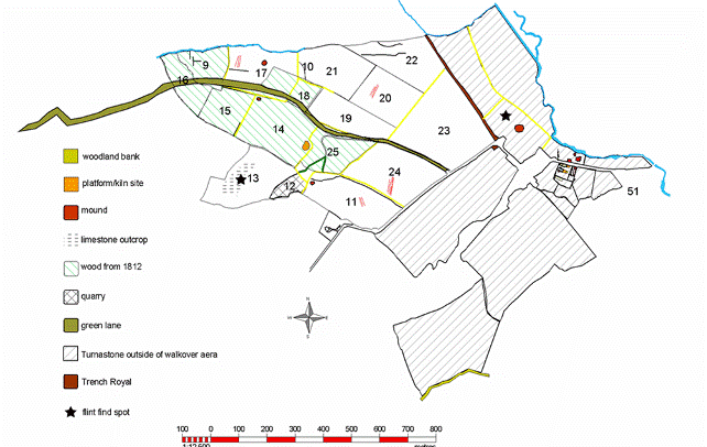
Figure 3: Archaeological features identified during thewalkover survey
A widevariety of features of archaeological interest were found to be present acrossthe study area. These include water management features such as channels andculverts and evidence relating to the extraction and processing of limestone.The land has clearly been the focus of successive patterns of intensive arableuse, as shown by the occurrence of traces of medieval cultivation in the formof ridge and furrow and associated headlands. Traces of the medieval embankmentof Chanstone wood are visible in the form of a very well defined woodland bankrunning along the top of the southern edge of a field to the south of thecurrent study area. Large areas of the highest parts of the land weresubsequently used as managed woodlands, probably comprising a mixed system ofcoppice rotation and wood pasture. The extraction of limestone and itssubsequent processing and the transport of materials away from the site havealso left traces in the form of quarrying, spoil tips and track ways.
2.1 Changes in land use
At leastpart of the Turnastone estate was open fields in medieval times: a trace ofstrip fields remained in the mid 19th century. The tithe map showsthat one of these plots remained in its medieval form into the mid nineteenthcentury. A plot of glebe land is shown as a long rectangular strip, cuttingacross later field boundaries (see figure 3 below). On maps from the early partof the nineteenth century the entire western part of the survey area was wooded(see figure 5 below) but by the mid C19th most of the trees appear to have been felled. Turnastone Court Farm is now a 247 hectare livestock farm whichhad been managed, using traditional methods, until very recently by the Watkinsfamily for over a century.
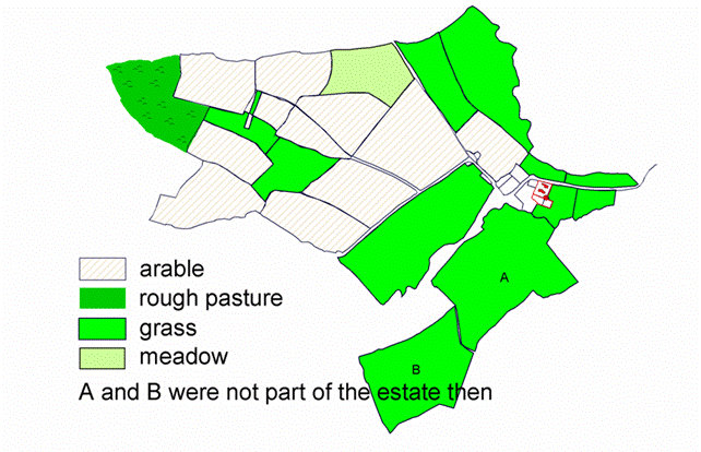
Figure 4: Plan based on the 1842tithe map showing land use at that date.
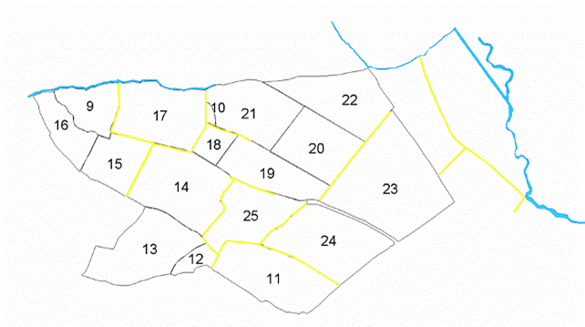
Figure 5: Hedgerows shown on the1842 tithe plan.

Figure 6: The extent ofTurnaston wood in 1812 and the course of the road leading from Turnastone toMiddle Maes Coed.
Only afew minor changes to field boundaries have been made and these were between1840 and 1886 in the north part of the farm. The pattern of hedgerows seen on the tithe map (see figure 4 above) is characteristic of upland agricultural practice in the area, with small fields bounded by amorphous hedge lines. Later enclosures are indicated by larger, more regularfields with straight field margins.
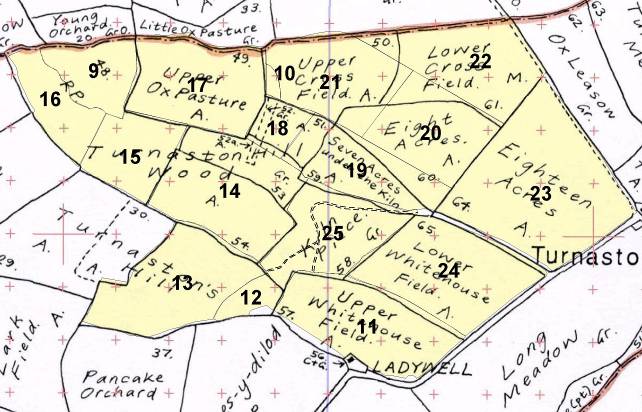
Figure 7: The study area showing the field names from thetithe apportionments.
2.2 Features identified during the survey
Field9
Field to the east of 16 andto the west of 17. This was part of Turnaston Hill Wood on the titheapportionments.
Land Unit: 5779 Area: 1.867 ha.
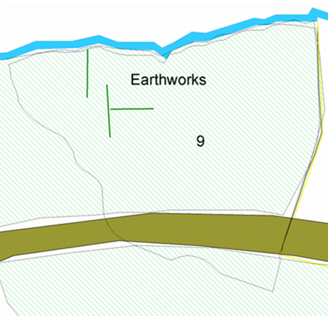
Figure 8: Turnaston wood in 1812
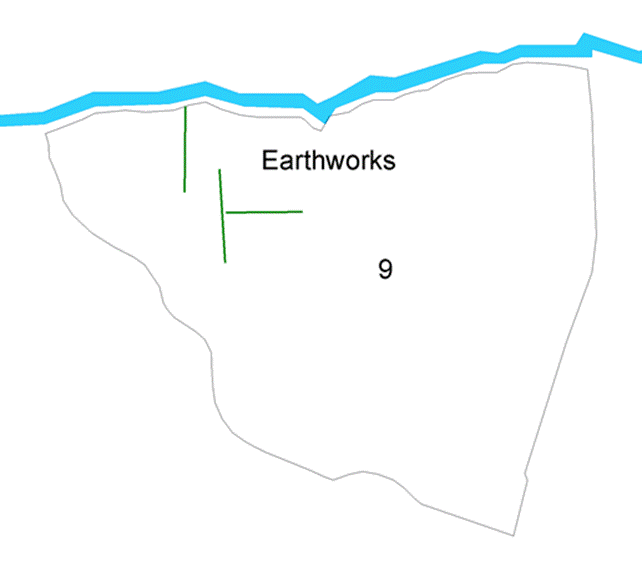
Figure 9: Earthworks in field 9
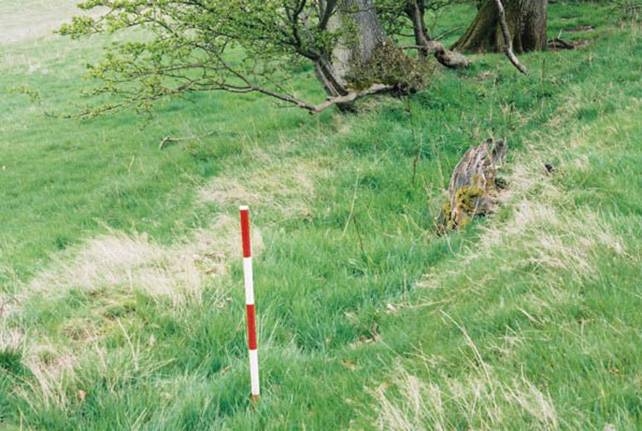
Plate 1: Part of earthworks 68.
One ofseveral linear earth and bank features in field 9. These features may berectangular field boundaries or headlands created during the ploughing ofmedieval cultivation strips. Further investigation will help to clarify theoriginal purpose of these earthworks.
Field11
Land Unit: 0831 Area: 4.186 ha
Fieldadjacent to and to the north of Ladywell Cottage (Upper Whitehouse Field in thetithe apportionments) and immediately to the west of the Turnastone to Whitehouse Bridge Road. This was 57 - Upper Whitehouse Field on Tithe.
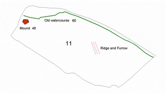
Figure 10: Earthworks in field11
Thefeatures identified in this field include a watercourse (60, see plate 3and figure 8), now overgrown, but which appears to have a stone lining presentin places; an unidentified mound (48, see plate 2 and figure 8) and possiblecultivation strips (ridge and furrow, see figure 8) which are indicative ofmedieval arable use of the land.
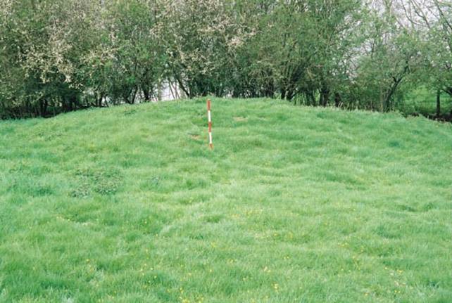
Plate 2: Mound 48
The moundis in the upper west end of the field and had no visible ditch surrounding it.The mound was just south of the hedge and is approximately 16 metres in diameter.
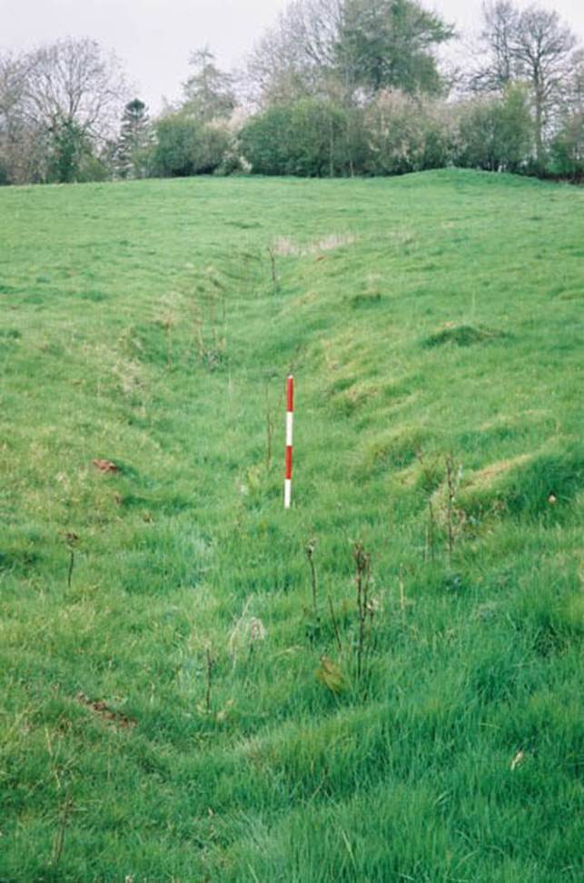
Plate 3: Watercourse 60.
Feature60 is probably an old watercourse that ran from the top of the slope to thenorth-east to the bottom of the field to the south-west. It is approximately1.5 metres wide and whilst now overgrown was possibly up to 1 metre deep. Anumber of springs are known to rise close to the north eastern extent of thefield (pers. com. Ian Hart). The function of this feature would thereforeappear to have been to channel water from these springs, either for irrigationor drainage.
Field 12
LandUnit: 8437 Area 0.356 ha.
Wood withquarry (61) immediately to the west of field 11 and to the east of field 13. Onthe tithe this was the eastern end of 55 Turnastone Hill.

Figure 11: Quarry 61 with oldhedge boundaries to the north-east
The oldhedge boundaries to the north-east are from Turnastone Hill, an old field shownon the tithe map.
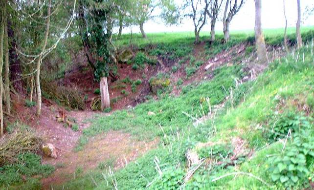
Plate 4: Quarry in field 12
The photowas taken facing north-east into the quarry that is now wooded. Turnastone wood(1812) was to the north-east.
A trackleads up to the quarry from field 25 with its route following the contours ofthe hill. The track would have been used for the transportation of rock fromthe quarry.
Field13
Land Unit:7139 Area: 4.178 ha
Field tothe west of wood 12.
On thetithe this was the greater part (western) of 55 Turnastone Hill
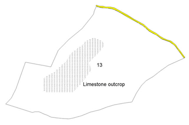
Figure 12: Limestone outcrop infield 13. The star marks the position of prehistoric flint find spots.
Thelimestone outcrop is one of the highest points in the survey area. There iseither a bank or natural shelf at the southern boundary of the field, possiblyrepresenting the geological start point of the outcrop. There is a depressionroughly in the centre of the field with exposed areas of stone. Prehistoricflints have been recovered from the field.
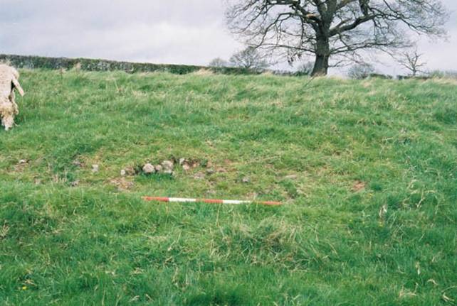
Plate 5: Feature 50 in field 13.
A line of mature standardtrees marks an old boundary of the field to the north-east.
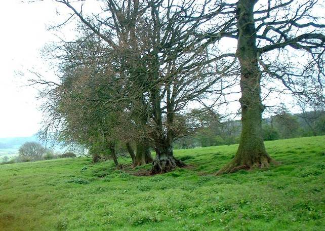
Figure 13: Grown out hedgerow 59
Field 15
Land Unit: 7560 (part) Area: 2.16 ha
Field tothe west of field 14 and to the east of field 16 - the eastern part of OSnumber 7560
On thetithe this was the southern third of 48 'Part of Turnaston Hill Wood'. Thefield was bounded on the north and east by old boundaries that survive from thetithe.
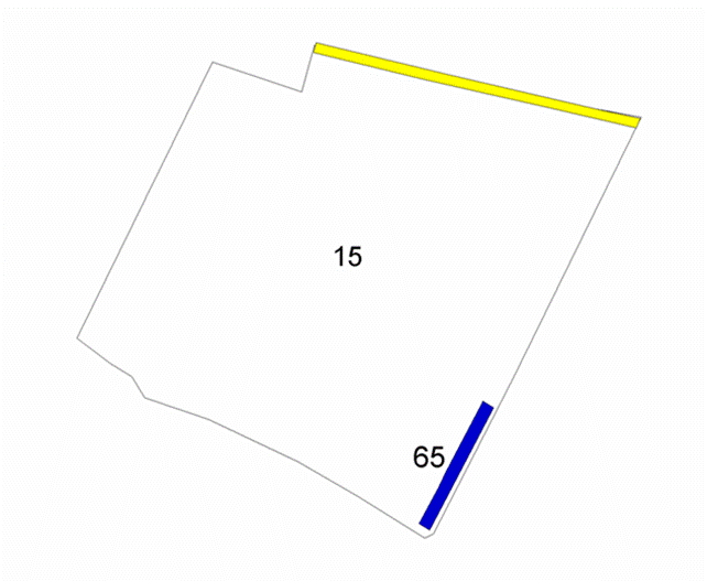
Figure 14: Culvert 65 and an oldditch and bank boundary
Culvert65 ran down from the south-west to the north-east and was stone lined. Waterwas still flowing through from the south-west taking water from high ground.The drain culvert possibly ran into field 17.
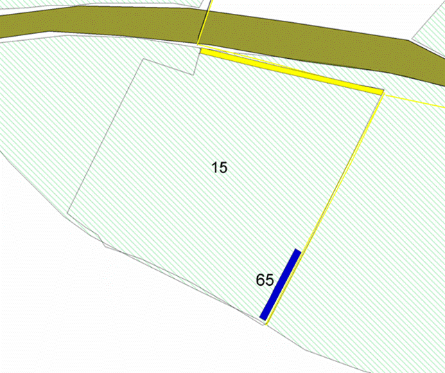
Figure 15: Turnaston wood 1812
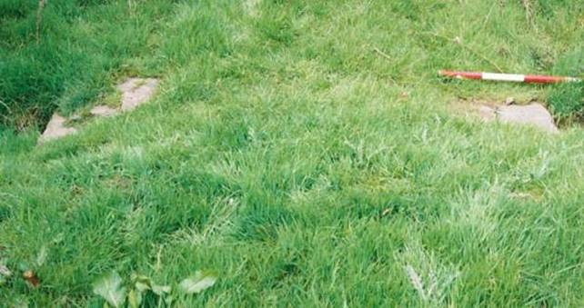
Plate 6: Stones from culvert 65 in the south-east corner offield 15
Field 17
Land Unit: 7478 Area: 3.952 ha
Field tothe east of 9, to the north of 15 and 16 and to the west of 18 and 21
On thetithe this was 49 Upper Ox Pasture
Thestream flows from the west, cutting a V-shaped valley that give fields eitherside its course quite a steep profile. The land drops quite sharply down to thebase of the valley. The stream disappears further downstream and does not boundfield 22.
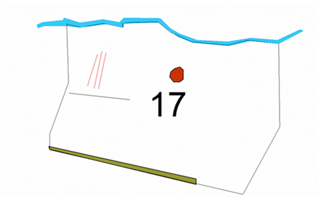
Figure 16: Archaeologicalfeatures in field 17
Apossible house platform/mound lies roughly central in the field. The mound isnot easily seen and was plotted onto the map from the SMR records. Ridge andfurrow within this field is indicative of medieval land use. A slight linearbank and ditch runs roughly east-west. This bank may represent the headland ofthe medieval open field.
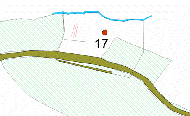
Figure 17: Turnaston wood 1812
Turnastone wood used tocover the south-east area of the field and the Turnastone to Middle Maes CoedRoad can be traced along the southern boundary.
Field 22
Land Unit: 2781 Area: 3.757 ha
Fieldnorth of 20, 21 and 23, and south-west of the Trench Royal (1)
Most, ifnot all of 61 'Lower Cross Field' and, some of 50 'Upper Cross Field' on thetithe. The south-east hedge boundary is old, surviving from the time of thetithe.

Figure 18: Crop marks in field22. The Trench Royal lies to the north-east.
Twolinear features run east-west. Cropmark 64 was, at time of the survey, verydefined and ran in an irregular line. The cropmark is possibly the undergroundcourse of the stream that disappears somewhere past field 17.
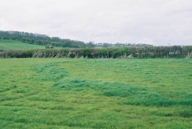
Figure 19: Cropmark 64
A faintditch also runs east-west through the field. It is possible that the stream waschannelled from its original course (presumably respected by the hedgerows) toirrigate the meadow.
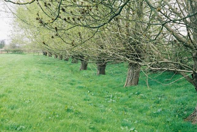
Figure 20: The Trench Royal on the edge of field 22
RegimentedWillows growing along the line of the Trench Royal. The trench is well definedin this area, surviving as a sizable earthwork. The trench is approximately 1.5– 2 metres in depth and 3-5 metres wide.
Field25
Land Unit:0149 Area 3.065 ha
Fieldbounded by 19 to the north, 14 to the west, 24 to the east. This field iscalled Kiln Piece in the tithe apportionments.

Figure 21: Field 25 showing the trackway and hedge boundaries shown on the tithe map.
Thetrackway comes from the old quarry in field 12 and leads down to meet the greenlane. A sharp bend in the track way occurs midway down the slope and this,together with the depth of the anomaly with respect to the surrounding fieldattest to the track probably having been used to cart limestone away from thequarry. The track forks into two and its southern extent appears to have ledto an area that still has a large number of roughly quarried blocks of stonelying exposed on the surface. This may have been a stone dressing area, orpossibly the site of a lime kiln, as suggested by the field name recorded inthe tithe apportionments in 1842. The hedges bounding this field are shown onthe tithe map and are likely to have already been in existence for aconsiderable time by then. A cropmark, possibly a ditch or watercourse, runssouth (down hill) from field 14 and is now only visible as a slight depression,with prevalence of clumps of nettles growing along its course.
3.0 Conclusions
3.1 Survival of archaeological features
Therelatively conservative pattern of land use that has been maintained across thesurvey area has allowed a wide variety of archaeological site types to survivefairly well. The Watkins family, the former owners of the estate were wellknown locally for their opposition to allowing large scale ploughing of theestate during the Second World War. Some infilling of negative earthworkfeatures and dumping of waste building materials, scrap metal and otherdetritus has, however, occurred. The latter is especially evident in the areaof the quarry above Ladywell, which was recently re landscaped to cover theworst of the protruding scrap with topsoil.
The landdoes not seem to have suffered unduly from over grazing, and the features thatwere evident appeared to be in generally good condition. Quite a lot of scruband bramble growth has obscured some of the higher parts of the survey area andthis meant that some features may not have been detected during this initialsurvey.
3.2 Recommendations for future management
Clearlythe ideal pattern of use to allow for the optimum preservation of the type ofearthwork features present across the estate is the continuation of the grazingregime currently in operation. The ploughing of fields for arable use shouldbe avoided, and overgrazing of the upland areas is also undesirable. Closeconsultation with the tenants should ensure that sensitive areas can bemanaged sensibly to avoid, for example, the poaching of the ground aroundearthwork features by grazing large numbers of cattle during very wetseasons. The future management of the farm and the requirements of the tenantsin terms of their long term business plan must be integrated into theCountryside Stewardship Agreement. Full recognition of the nature and type ofarchaeological features present on the farm together with the baselinestatement of the current state of preservation and land use on and around thesites should be included in the detailed schedule of management for each landparcel.
4.0 References
GeneralBibliography
| British Geological Survey 1979 | Geological survey 10 mile map, south sheet, 3rd edition (solid) 1979 1:625000 |
| Copleston-Crow, Bruce, 1989 | Herefordshire Place-Names, British Archaeological Reports, British Series No 214 |
| English Heritage, 2004 | Farming the Historic Landscape caring for archaeological sites in grassland |
| Thorn, Frank & Caroline, eds, 1983 | Domesday Book, Herefordshire. Phillimore |
Cartographic material
| Tithe Commissioners, 1842 | Turnastone Parish Tithe Map |
| Ordnance Survey, 1886 | 1st edition 1:2500 plan. County Series, Herefordshire |
| Ordnance Survey, 1904 | 2nd edition 1:2500 plan. County Series, Herefordshire |
[1] Herefordshire Sites and Monuments Record No 1106
[2] Herefordshire Sites and Monuments Record No 1107
[3] Herefordshire Sites and Monuments Record No 1108
[4] Herefordshire Sites and Monuments Record No 8475, 8476, 8477
[5] Herefordshire Sites and Monuments Record No 1486
[6] Herefordshire Sites and Monuments Record No 1484
[7] Herefordshire Sites and Monuments Record No 1461
[8] Herefordshire Sites and Monuments Record No 1123
[9] Herefordshire Sites and Monuments Record No 1416
[10] Herefordshire Sites and Monuments Record No 4357, 4358
[11] Herefordshire Sites and Monuments Record No 4357
[12] Herefordshire Sites and Monuments Record No 4293
[13] Herefordshire Sites and Monuments Record No 4352
[14] Herefordshire Sites and Monuments Record No 4353
Ref: rs_gdv_0083