
Held at: | Brothers Collection |
Reference: | RS |
Source: | Original document |
Title: | Digital Archive: Map of Services at Madley Airfield |
Place name: | Golden Valley |
Date: | 1941-1945 |
Description:
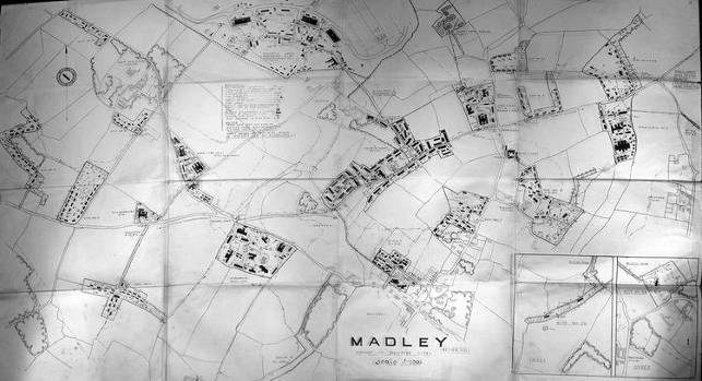
Map showing the detailed layout and designations of the service facilities at Madley Airfield during the Second World War. The map is marked “Restricted”, and shows precise details of the ‘dispersed sites’ around the airfield, including drainage, water and electricity supplies, fire hydrants, stop cocks, air raid shelters, barrack huts, aircrew messes, paths and access roads.
Follow the link to download a high quality map of the World War 2 airfield and services at Madley as a JPEG file
Observations:
None
Ref: rs_gdv_0131